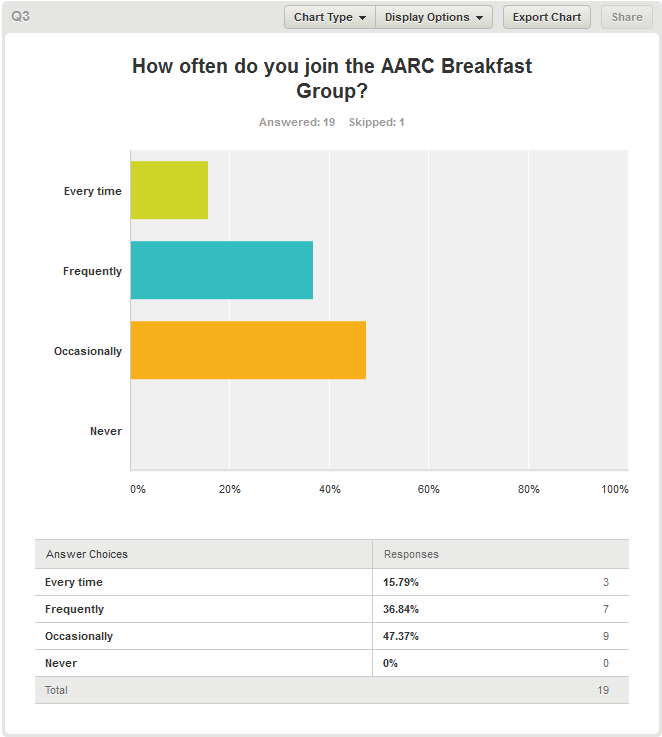
Thanks for all the responses. The results are in!
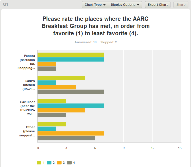
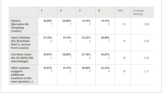
A number of interesting suggestions about alternative locations were made:
Bodos off Rt. 29
DoubleTree (breakfast bar)
Harris Teeter (has a breakfast bar and a cafe area and a Starbucks)
IHOP
McDonalds
One of the breakfast buffets
Spudnuts
Waffle House
Tip Top (we’ve checked with them, and they say they can’t handle a group like ours on Saturday)
Wood Grill
Stay tuned for further news as we digest these results…… Read the rest