
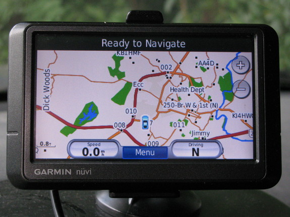
Garmin Nuvi 255W GPS
Photo: AK4OL, CC-BY-3.0-US
Do you know how to get coordinates in and out of your GPS? As staggering as this is, given that latitude and longitude are the fundamental units a GPS works with, many older car GPS units don’t let you enter or retrieve these coordinates. And even when they do, some users don’t know how to use these features. A GPS is an important tool at a public service event or emergency response.
At a recent public service event, we had a rest stop at a location that baffles many GPS, google earth, google maps, etc. First, the White Hall Community Center is not known to these systems. Worse, many GPS units have trouble finding the intersection of two roads; even though they have a mode for this, in the map data itself the streets don’t always register as intersecting. Garmin GPS doesn’t find Wyant’s Store across the street and google earth/maps have this store in a completely wrong location (though unlike the GPS, they can locate the intersection by road numbers). So, this is just one example of when you need to use coordinates.
On a Garmin Nuvi 255W, you can enter coordinates at Where To -> (scroll down arrow) -> Coordinates. In the coordinate screen, there is a “format” button on the bottom edge of the screen you can use to selected decimal degrees, Degrees/Minutes/Seconds, etc. However, on a newer garmin 2945LXT? you may have to go to Where to -> add favorite -> (scroll down) -> Coordinates to get the entry screen (which then may later appear under Where To. And you have to hit an obscure 3 horizontal bar icon in the upper left corner to bring up a menu which has “Format” as an option. In either unit, you can tap the car icon in the middle of the map, to pull up the “Where Am I” screen which includes longitude and lattitude. The format of this display may be dictated by the format you selected when you last entered coordinates.
Note that modern software tends to use the more sensible decimal degrees. Longitude is often given as negative since we are west of the prime meridian. Why deal with four or six numbers when you can deal with two? N 38° 7′ 4.4394″ W 78° 39′ 42.372″ or 38.11790, -78.66177 ?
38.06028, -78.71130, Old Trail Swim Club
38.05493, -78.75600, Greenwood Community Center
38.16237, -78.48994, Broadus Wood Elementary School
38.11790, -78.66177, White Hall Community Center
38.24017, -78.61606, boonsville rest stop
Note that you may also see Universal Transverse Mercator (UTM) coordinates. These have an X, Y, and zone value: 704980.0563 4221273.095 17
Note that the programs ll2utm and utm2ll from drawmap package can be used to convert to/from UTM. I had to recompile on ubuntu because ubuntu package was compiled incorrectly and omitted these utilities.
gpsbabel is a very useful utility to convert between different formats of GPS files.
On my Garmin 255W I was able to upload waypoints as favorites but it ignored routes and tracks.
I put .pgx files in the “Garmin/GPX/” directory, by treating GPS as a USB disk drive, and the points showed up under “All Favorites”. Thus the route for the bike ride did not appear. Garmin Trail GPS would show the route. Perhaps if the files were on an external SD card, the “Import Route from File” option would appear under Tools -> My Data. That works on some Nuvi’s. Reportedly, though, this model doesn’t support routes (specs say Routes: 0). This is a problem with Garmin and other GPS manufacturer selling crippled units. The unit which works in your car may not work on the trail, geocaching, in an airplane, in a boat, on a bicycle, etc. and vice versa, even when it is within the physical abilities of the device. If you have a gps that doesn’t support routes, add a bunch of favorites along the route at strategic locations, major turns, and anywhere else need to prevent the gps from navigating off route and set your destination and add stratigic waypoints as via points to force the route. On bike routes, you might put the mile marker at the start of the name. On Garmin Nuvi, via points are added by using “where to” with a destination already set – it will ask if you want to change the destination or add a via point.
Note that for bike rides, we might want to navigate a route forward or backwards or to any point along any route and starting from any point on the route. And stay on route when we do.
Cell phones may have GPS navigation features but may not support coordinates, GPX routes, or tracks. And what features they do have, may not work without cell phone coverage (they usually don’t have the maps on board, they download as needed over the cell network). Sprint is also notorious for crippling their cell phones so third party software can’t use the built in GPS.
I did not have luck using this GPS from USB except as a mass storage device. Some can act like a serial device for uploading/downloading from gpsbabel and other programs and also can output NMEA data to report the current position in real time so you can use with mapping software on your computer.
And if you plan on using your tablet/notebook/laptop, make sure the maps can be and actually are downloaded onto your device for offline use.
Some links regarding using Garmin on Linux:
http://wiki.openstreetmap.org/wiki/USB_Garmin_on_GNU/Linux
http://www.gpsbabel.org/htmldoc-development/fmt_garmin.html
http://www.gpsbabel.org/htmldoc-development/fmt_garmin.html
http://wiki.openstreetmap.org/wiki/OSM_Map_On_Garmin/Mass_Storage_Mode
Linux GPS navigation programs include google earth (online), KDE marble, gpsdrive, roadnav (hasn’t been updated in along time), navit, vIking, and Xastir (APRS).